How to do a survey for reLEAF
Before you start, contact releaf@nullzeroch.org to establish whether the area has already been surveyed.
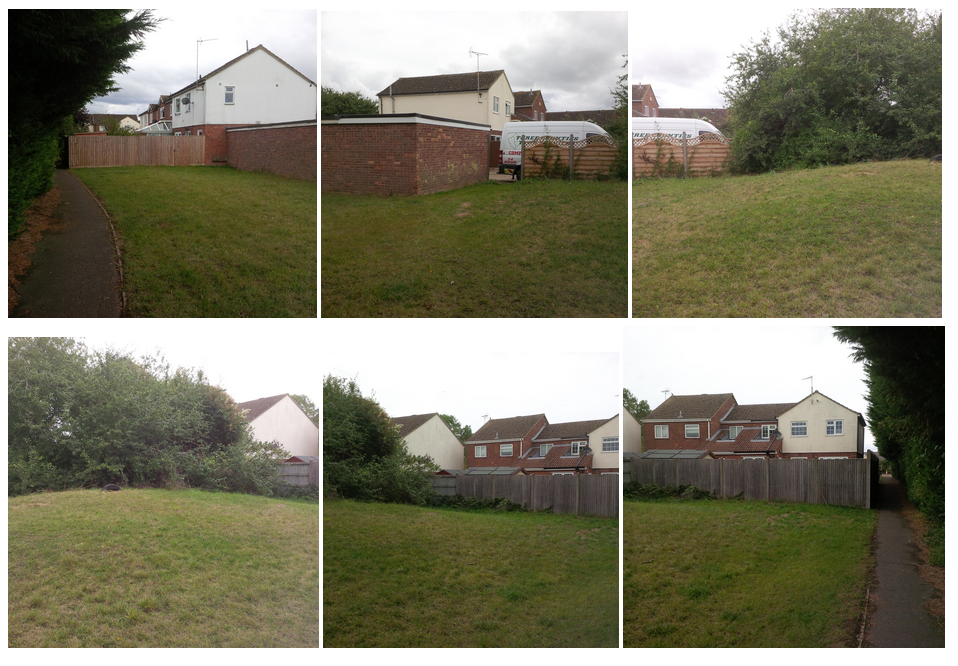
Take photographs of each site.
You might find it helpful to use openstreetmap.org to mark the potential planting sites on
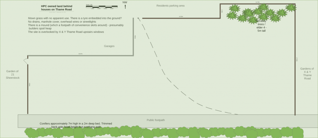
Draw up a plan of the site as it is at the moment. This can be hand drawn & then scanned. On your plan record:
- Parish council land / private land / roadside verge (NB roadside trees can only be planted by Buckinghamshire Council but we can apply for them)
- Drains or manhole covers – the position of them or the fact there aren’t any visible
- Overhead wires – the position of them or the fact there aren’t any Streetlights – the position of them or the fact there aren’t any
- Paths
- Unofficial paths
- Fences, walls, gates
- Road name & numbers of houses that are on the boundary
- Windows that look on to the area
- Trees already present – approximate height and diameter of canopy. Identify the trees if you can
- Other vegetation already present
- Draw on a North arrow
- Mark approximate dimensions (pacing is good enough)
If you have suggestions of what trees would be appropriate for the site please make them (but not on the plan)
Put your photographs, plans and suggestions into one clearly named document for each site eg Land near garages and footpath at top of Sheerstock
Send your survey to releaf@nullzeroch.org